Queensland maps
-
Community Maps – Brisbane City CouncilCommunity Maps is Brisbane City Council's web mapping application that provides an interactive experience to view maps and location-based information.
-
Queensland Government. Department of Natural Resources, Mines and Energy MapsIncludes topographic, historical, mines and resources
-
Queensland Government. Department of Environment and ScienceMaps of coastal zones, environmental management, heritage (including shipwrecks and archaeology), wildlife and ecosystems.
-
See also Guide to Planning: Urban and RegionalPlanning schemes and property information
Australian maps
-
Geological maps - AustraliaMostly in print.
-
Australian Geoscience Information NetworkThe AusGIN Geoscience Portal - providing discovery, display, and download of geoscience data from all government geological surveys.
-
National Native Title TribunalA collection of maps representing native title claimant applications, determinations and land use agreements.
-
AIATSIS map of Indigenous AustraliaThis map attempts to represent the language, social or nation groups of Aboriginal and Torres Strait Islander Australia.
-
Decolonising historical maps in the National Library of Australia collectionHistorical maps can be useful when researching Aboriginal cultural landscapes and they can help researchers develop family histories, trace trading paths and Songlines, investigate traditional fire management regimes, reconstruct land use patterns, and explore local languages.
-
NearmapHigh quality 2D photo maps of Australian cities and towns updated 6 times a year. Useful for planning, architecture and construction, environmental studies and insurance studies.
World maps
The Internet provides access to many map catalogues and full images of maps. Try some of the following sites:
-
David Rumsey Map CollectionThe David Rumsey Map Collection was started over 30 years ago and contains more than 150,000 maps. The collection focuses on rare 16th through 21st century maps of North and South America, as well as maps of the World, Asia, Africa, Europe, and Oceania.
-
University of Texas. Perry-Castañeda Library Map CollectionExtensive range of historic and other maps.
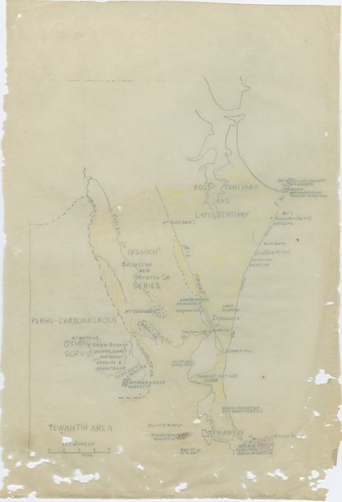
Map of Australia

Ortelius World map
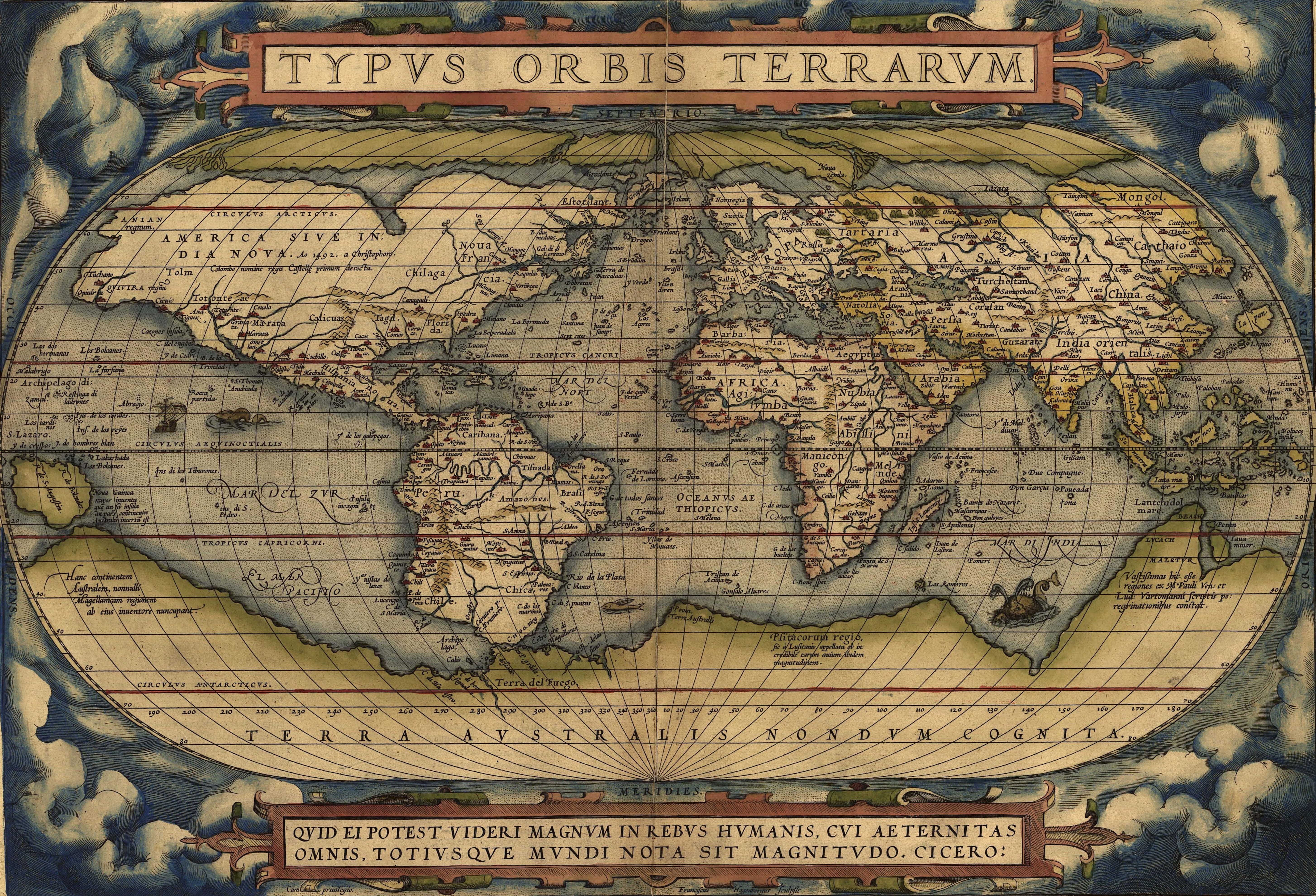
Source: Ortelius World Map, Typvs Orbis Terrarvm,1570.